
Let's go surfing!
With its origins in the early 80's I am fascinated by the ocean, the wind, the beaches and surfing. The idea of my first own website came in the mid 90's when I was searching for information on some remote places. I travelled, enjoyed and shared my experience with other enthusiasts. Some of my reports are more or less a review, but maybe they can still impart the spirit of what our sport is about. What you will find here:
- Ideas and information on travel destinations, combining opportunties for an individual trip and exciting wind- and kitesurfing
- Reports on locations, that are not yet crowdy or praised on package tour websites
- Portraits of selected popular spots
- Alleviation of surfer-specific withdrawal symptoms
- Impressions and photographs, that may foster your own travel ideas - all free of advertising
| Australia | A windsurfing trip to West OZ |
| Bonaire | Colorful island |
| Brazil | São Miguel do Gostoso |
| Cabo Verde | Capverdian Islands - Sal |
| Chile | Entre Olas - endless solitary beaches, waves... |
| Oman | Masirah Island - powerful place |
Western Australia
Australia undoubtly is one of the top-ranking travel destinations for many people. The 5th continent is synonym for a gorgeous landscape, for the unique flora and fauna that has developed there exclusively and it amazes its visitors with impressing wild life and lively metropolises. 'Downunder' stands for a new world, for the feeling of great latitude, for adventures in rough nature and also for nativeness. These cliché-like attributes however may reflect the spectrum of what you really can see and experience just as little as the attempt to name representatives of all styles of Australian music by listing AC/DC, Men without Work und Kylie Minogue. Even if my small contribution will also be everything but comprehensive I would like to give you insight to some highlights of our journey through Western Australia including a short trip to Sydney both of which changed at least my personal view of Australia along with unexpectedly varied impressions.
The Windsurfing season in Western Australia starts approx. in the beginning of October and lasts until March / beginning of April. Of course there are also good conditions off-season but they are far less regular. For those of you being absolutely determined to go to Australia my report may foster your plans to find your way to this fascinating continent. For those, who are rather sceptical I hope to be able to outline that Australia does not only consist of red desert sand, sparse vegetation and kangaroos jumping around. The rest of you may sit back and relax.
Perth with its about 1.4 million inhabitants is the only major city within Australia's largest federal state. The pleasant metropolis with its international airport is the ideal starting point for your journey through Western Australia and it is worth while a stay to experience its atmosphere and the citizens' lifestyle. The loneliness is still to come! ;-) Besides the busy downtown and the "must see" Kings Park I visited also some suburbs and the interesting urban zoo. Do not miss to go to the neighbouring city of Freemantle, which is named after Captain Charles Howe Fremantle, who took this once unloved part of the 5th continent for the British crown on 2 May 1829. My girlfriend lived in Perth for 3 month, so I was very lucky to have my personal guide. ;-)
Those who are already keen on surfing may either make a run on the sandy beaches west of Perth or fill up fuel to start the way North.
On our introductory route starting from Perth southwards along the coast we faced a side of Australia which was at least completely new to ourselves: luxuriant woods with gigantic eucalyptus trees, regions full of flowers, fantastic beaches, varied routing instead of dusty, monotonous desert roads.
Contact me if you are interested in the full article. Be it to have additional arguments to bring forward to your girl-friend or friend before you both get enthusiastic about starting the long trip to Australia...
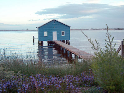
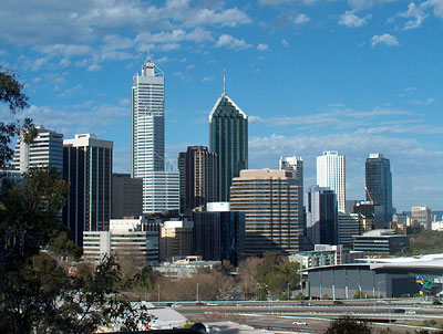
Perth offers metropolitan atmosphere and nature side by side.
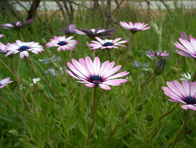
Wildflowers of Western Australia
surfingdave
Ein Besuch im Paradies
Report in German
Freunde zu besuchen, ist eine feine Sache. Wenn diese Freunde dann auch noch auf einer kleinen karibischen Insel wohnen, die mit türkisfarbenen Lagunen, kleinen Häuschen im Kolonialstil und einem sehenswerten Nationalpark gesegnet ist, gleicht das wohl schon einem Traum. Zum großen Glück fehlten lediglich 2 Wochen Urlaub und ein Flugticket, mit dem ich der Einladung zum Besuch sehr gern gefolgt bin.
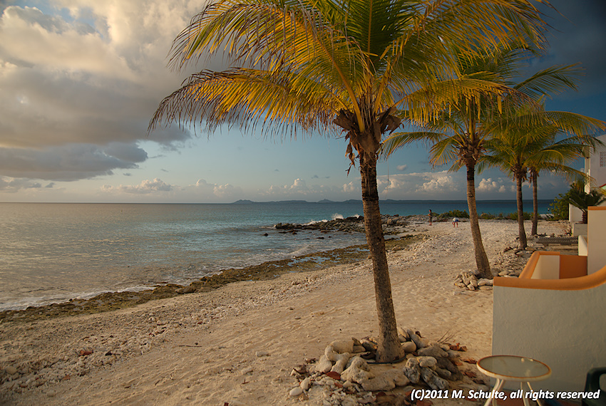
Hausstrand
Blick von der Terasse
Die ganz besondere Gemeinde der Niederlande liegt unmittelbar vor der Küste Venezuelas und ist mit gerade einmal 288 km² das zweitgrößte Eiland der sogenannten ABC-Inseln, die geographisch zu den Kleinen Antillen gehören. A wie Aruba, B wie - na? - genau, Bonaire! und C wie Curaçao. Die geographischen Gegebenheiten lassen erahnen, was spätestens nach der Landung auf dem winzigen Flughafen spürbar wird. Es ist kurz vor halb sechs Uhr morgens, eine leichte, lauwarme Brise begleitet die Passagiere auf ihrem letzten Wegstück über das Flugfeld. In der kleinen Abflughalle deuten einige bunte Surfsegel am Ausgang, wohin die Reise geht.
Ich habe mein Starboard Evo dabei, offensichtlich das einzige Surfgepäck unter unzähligen Taschen und Kisten mit Tauchausrüstung. Derart bepackt freue ich mich um so mehr, als ich Claudia am Ausgang erblicke, die mich zu dieser nachtschlafenden Zeit vom Airport abholt. Schnell ist alles auf den Pickup geworfen und wir fahren der aufgehenden Sonne entgegen. Palmen und eine Reihe zum Teil luxuriös anmutender Villen säumen den Straßenrand. Am Horizont erkenne ich schneeweiße Hügel. Es ist wohl doch noch ein bisschen früh am Morgen, denke ich und staune, während Claudia mich über ihre Pläne für den heutigen Tag aufklärt.
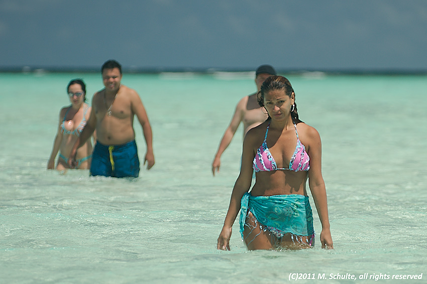
Man trifft sich in der Lagune.
Nachdem wir Peti dieses Foto zugemailt hatten, waren seine letzten Zweifel ausgeräumt.
Noch vor den imposanten Salzbergen biegen wir in einen kleinen Kiesweg ab. Eidechsen huschen davon, während wir mit offenem Fenster und wehenden Haaren die wenigen Meter bis zum Haus meiner Freunde zurücklegen. Von Claudia's Blog und einem ihrer Videos wusste ich ja bereits, dass das Appartmenthaus direkt am Meer lag. Als ich es aber life und in Farbe vor mir sehe, verschlägt es mir fast den Atem. Wir queren einen kleinen Vorgarten mit üppiger Vegetation - mir fallen gleich die wundervoll blühenden Büsche auf - öffnen die mit Fliegengitter bestückte Fronttür und stehen in einem Wohn- und Esszimmer, das den Blick auf das Meer über eine die gesamte Breite des Raumes einnehmende Fensterfront freigibt. Wahnsinn sage ich, öffne die Schiebetür zur kleinen Terasse einen Spalt und stehe nach höchstens 5 Schritten direkt an der deutlich vernehmbaren Uferbrandung am Lighthouse Beach.
Müde wie ein Hund nehme ich gerne den morgentlichen Kaffee an, wir plauschen noch ein wenig, nachdem wir uns so lange nicht mehr gesehen hatten. Die Windvorhersage für den Tag ist gut, jetzt muss auch David aus den Federn. Schnell haben wir unsere Sachen gepackt und machen uns auf den Weg. Während David sich bereits im Pickup ausgiebig mit Sonnencreme einschmiert, blicke ich über die weite, mit zahlreichen Büschen bewachsende Ebene. Ziegen und Esel laufen frei umher, im flachen Wasser der Lagunen waten rosa Flamingos. Ganz entzückt von diesen Reizen erinnern mich erst tiefe Schlaglöcher und eine im letzten Teilstück völlig ausgefahrene Straße daran, dass ich nicht träume.
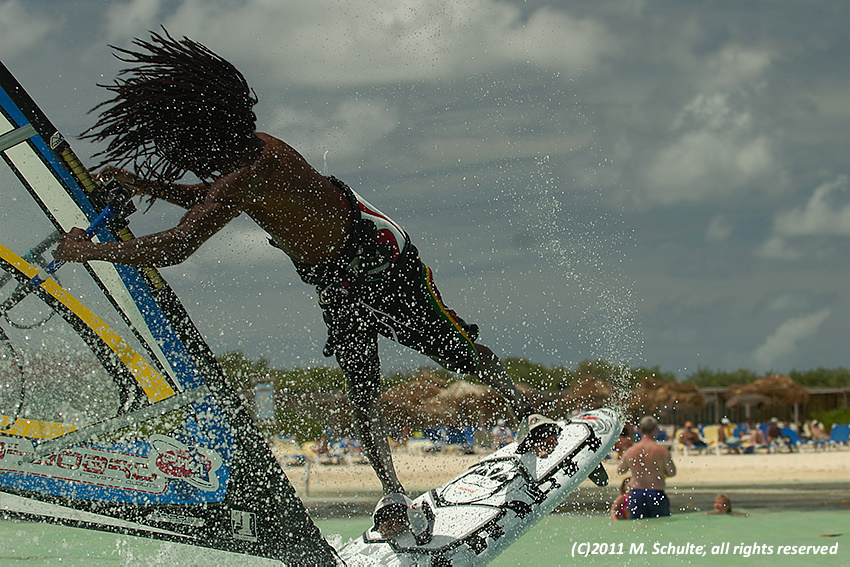
Jay in Aktion - ob Volcan oder Spock - da wird's dem Fotografen schon beim Zuschauen schwindelig ;-).
Schreib mir, wenn Du den kompletten Bericht mit allen Bildern erhalten möchtest (kostenfrei).
surfingdave
São Miguel do Gostoso, Brasilien
Report in German
Ein Surftrip nach Brasilien stand bei mir schon länger auf der Wunschliste. Es war November, es war ungemütlich und der Winter stand vor der Tür. Was kann es da Schöneres geben, als die Aussicht auf Temperaturen um die 30°C, beständigen Wind und einen entspannten Urlaub in Südamerika? Ich hatte bereits einiges über Jericoacoara ("Jeri") gehört und auch über die inzwischen fast ebenso bekannten Spots Combuco, Icaraizinho, Flecheiras, Florianapolis und Ibiraquera gelesen. Zumal ich touristisch weniger erschlossene Reviere solchen mit bekannt guter Infrastruktur vorziehe, fiel meine Wahl nun also auf São Miguel do Gostoso.
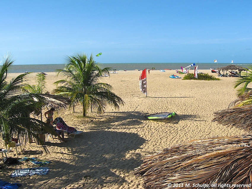
Strand am Punto do San Cristo
Blick vom Sonnendeck der "Dr. Wind" Surf-Station
Der kleine Ort mit dem wohlklingenden Namen liegt im Norden Brasiliens im Bundestaat Rio Grande do Norte. Bedenkt man, dass es hier am östlichsten Zipfel Südamerikas bis vor rund 10 Jahren noch nicht überall Strom gab und dass technische Errungenschaften wie ein Mobilfunknetz auch erst seit relativ kurzer Zeit verfügbar sind, kann man sich vorstellen, welche Veränderungen die Menschen vor Ort erleben. Fischer sitzen vor Ihren Hütten und flicken ihre Netze. Zu Ihren Booten, die hinter der Brandung vertäut sind, gelangen sie zumeist mit kleinen Flößen. Hühner, Ziegen und Rinder laufen zwischen den Häusern und auf der Straße umher. Auch wenn das Hauptverkehrsmittel Motorräder zu sein scheinen, die tagsüber wie nachts lautstark über die mit Schlaglöchern gespickten Straßen knattern, begegnet man immer wieder dem einen oder anderen Ochsenkarren, mit dem Menschen oder Waren transportiert werden.
Zum Glück gibt es aber auch hier Busse, die einen von der knapp unter 1 Million Einwohner zählenden Metropole Natal in gut 2 Stunden über ca. 150 km Landstraßen nach Gostoso bringen können. Für weiteren "Vortrieb" sollte dann ja letztlich der beständige Wind sorgen, der Brasiliens Küstenabschnitt zwischen Natal und Fortaleza mit großer Regelmäßigkeit verwöhnt.
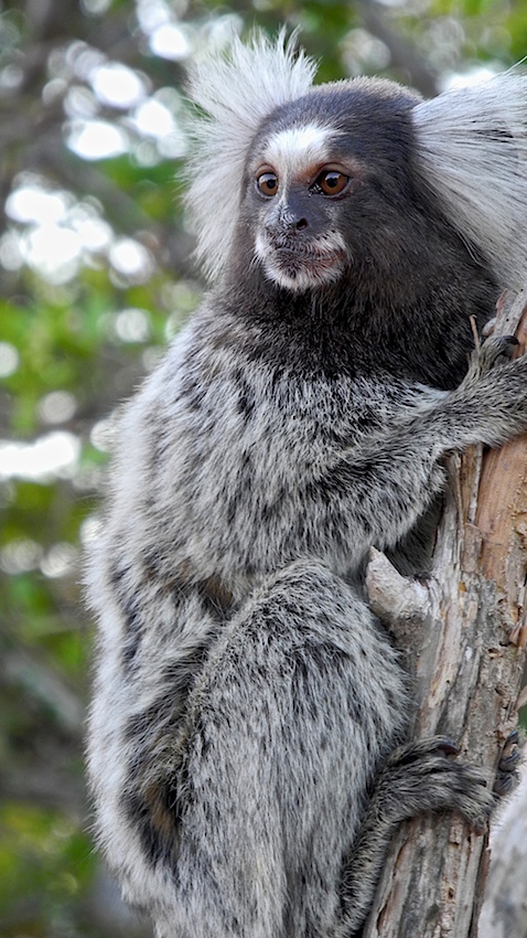
Es gibt immer was zu sehen...
Diese kleinen Freunde begegnen Dir auf Deinem Weg. Mein besonderer Dank gilt Viktor, dessen Kamera ich für diesen Schnappschuss benutzen durfte.
Mit bereits 2 Surfstationen findet man eine beinahe unerwartet gute Infrastruktur vor. Platzhirsch am luvseitigen Teil der weitläufigen Bucht ist die "Dr. Wind" Station von Paolo Migliorini, einem ausgesprochenen netten ehemaligen Windsurf-Worldcupper. Paolo und sein freundliches und überaus hilfsbereites Team lesen ihren Gästen die Wünsche fast von den Augen ab. Die "Hausmarke" ist RRD, darüber hinaus gibt es Riggs von Neil Pryde und The Loft. Die Segel kann man sogar ganz bequem auf dem Rasen aufriggen. Auf Höhe der Ortschaft Gostoso, etwa 1 km windabwärts befindet sich eine weitere Station, die kein geringerer als Kauli Seadi im Oktober 2010 eröffnet hat. Mit JP Australia und Neil Pryde ist dieser 2. Club, den Kauli neben seinem Heimatspot Ibiraquera betreibt, sehr modern ausgestattet.
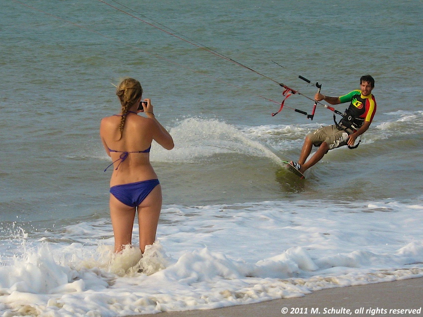
... und zu fotografieren...
Ich habe während meines Aufenthalts nur wenige Aufnahmen gemacht. Aber manchmal musste es eben doch sein.
Einmal auf dem Wasser, bekommt man das breite Grinsen. Bei Badewannentemperaturen geht es mit Shorts und Lycra über eine meist leichte Brandung zunächst über kleine aber regelmäßige Wellen, die man vor Glück gleich zum Abheben nutzen möchte. Einige Hundert Meter weiter draußen entsteht luvseitig an einem vorgelagerten Riff und an sich in Lee anschließenden Sandbänken eine bis zu ca. 1,5 m hohe Welle, die zum Spielen einlädt und es dank ihrer relativ geringen Kraft auch Einsteigern ermöglicht, erste Erfahrungen im Wellenreiten zu sammeln.
Der Wind weht in der Regel side- bis sideoffshore von rechts. Ich habe selten ein so beständiges Windsystem erlebt. Selbst nach zeitweisen Störungen durch Regenfronten - die sogar für Locals ein Novum für diese Jahreszeit darstellten - wehten während meines 14-tägigen Besuchs immer zwischen 17 und 22 Knoten (von der Station angezeigte Werte). So wundert es auch kaum, dass die meisten Windsurfer jeden Morgen erst einmal "blind" ihr Lieblingssegel aufbauen. Gut zu wissen, wenn man sein eigenes Material mitbringt: Mit 2 Segelgrößen kann man hier schon auskommen. Auch den Neo kann man zuhause lassen. Ich fahre sonst fast immer mit Shorty, aber in Gostoso lag er nur herum. Bis Du im Wasser bist, stehst Du sonst im Schweiß!
Schreib mir, wenn Du den kompletten Bericht mit allen Bildern erhalten möchtest (kostenfrei).
surfingdave
Cabo Verde
The Capverdian Islands are located 450 km (280 miles) west of Senegal's coast and 1,500 km (940 miles) south of the Canary Islands and form the outmost southern group of islands near North Africas coast. The Capverdian archipel consists of nine inhabited and six unoccupied islands, being arranged in the shape of a horseshoe with its opening to the West. In the southern part of the „horseshoe“ are the leeward so-called Sotavento islands, e.g. Brava, Fogo, Santiago and Maio. The windward Barlavento islands in the North are Santo Antão, São Vicente, São Nicolau, Boavista and Sal. Nearly all year round the northeastern Passat winds determine this region's climate and invite you with wind forces of about 11 to 25 knots.
As a windsurfer you'll reach Sal easily via the international airport which originated from Sal's role as an important stop-over place in the Atlantic Ocean. However, once you have left the clearance hall you will notice that you are going to be on a desert island on which one of the very few substantial employments of the inhabitants is to offer transport services to tourists and natives. Taxis will be at your disposal in rows. The drivers may pester the new arrivals and proudly present their remarkably modern cars being set up like tiny living rooms. The favour to their automobiles must have been the reason for considering my transport - along with boardbag, sailbag, how otherwise, but without any roof rack (for what?) - to be unattractive to them or to be too harmful to their cars at least. Finally I found a driver with a pickup. After he had fixed my equipment rather with his clothes-line than with my straps we could however start into the nocturnal desert ...
During my stay I lived in the island's capital: Espargos. There is a centrally located hotel, where sometimes also "business" people ask for lodging and there are some nice pubs and small restaurants as well. The place appears to be rather chaotic, the inhabitants however are very hospital. It is a clear advantage if you speak Portugese in the Republica de Cabo Verde which gained its independency from Portugal in 1975. The more you leave Espargo's center behind you the more wretched are the housings. Cape Verde is not an economically prosperous place. In the evenings the restaurants' owners offer their guests a variety of really tasty fish and seafood. Those ones who know tuna only in the shape of fragments or lumps in cans will be surprised what else can be prepared with that considerable fish. For a first trip it is a good idea to board one of the mini busses. Similar to the armada of taxis this public transport starts at the central place and usually takes its route through the village before it heads towards its actual destination. Playing records with the typically cheerful and danceable music the bus driver departures as soon as the passengers sit penned in along with chicken and other valuables. The direct meeting with natives will not only be ensured but also very interesting and entertaining.
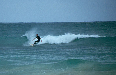
Santa Maria is connected to Espargos via a well-built tar road and - despite of the drivers' regular question where you wish to go - more or less is the only destination possible. Once you have arrived, the spacious sand beaches take away your slightest doubts. On a longitude of about 8 km (5 miles) the turquoise, wonderfully warm seawater attracts you (21-27°C). Only towards the East your nose may be temporarily insulted by the odour of a fish factory located at Santa Maria's periphery. There are some nice waves to ride (acc. to the 'Worlds' Storm Riders Guide' up to 8 ft.) although you are confronted with a beach break typically. The best swell is reported from a location called 'Ponta Preta' about 30 minutes by foot from Santa Maria. Unfortunately I could not gain any experiences concerning that spot on my own because of poor wind. For waveriding the months November - February are said to be promising. The best prospects for wind - as far as I could derive from several statistics - are during the period from January - May. While you may also be lucky in June, you should consider the Canary Islands as a better choice if you plan your trip for July. During summer there may arize a hot and humid southwestern wind in the Capverdian archipel, a kind of monsoon, that can bring about as much rain in one day as it equals the normal yearly amount. This is expected to happen only if the equatorial low pressure zone moves northwards far enough. This seldom constellation must have had occured during my trip as I was very concerned when I arrived with the minibus one morning. The wide beach including the first row of bungalow sites were flooded. I used to simply drop my stuff directly at the beach and I was lucky that I had mounted it on a rack just above flood level. :-)
Besides the hotels Belorizonte, Morabeza, Aeroflot and a surfers' bar under the management of Patrick Heintz there wasn't any noteworthy touristic scenery during my first visit in 1996. I liked it for I could enjoy watching the fishermen carry huge tunas in wheel barrows on the repeatedly repaired landing stage in the evenings. Meanwhile especially the infrastructure of Santa Maria has been subject to changes in view of the tourism.
If I head towards the Capverdian Islands the next time I am going to take my time visiting the more attractive sceneries of the surrounding islands, as well.
surfingdave
Chile
Entre Olas - a journey along the wave sites of the Humboldt stream
Well in advance of our trip we have intensively studied available information on the web. We therefore do not claim any pioneers' entitlement. In view of your own practical and comprehensive preparation I have compiled our most important information sources which you may receive on request. An excerpt of the information has been incorporated in this website however, and the following may serve as a status report and a foretaste on an interesting destination as well. One thing is for sure: Chile is not advisable for people requiring warm shower baths!
We had been looking forward to our new project nearly throughout the complete year. The autumn coldness and the continuously decreasing number of daylight hours did not allow any doubts about the fact that we wouldn't have any further opportunity to go windsurfing in our home country. Eventually our trip began on 23 October: Departure to Chile, where the utmost beautiful spring rules at that time.
It takes you about 16 hours of flight before you reach the modern but overlookable airport of Santiago de Chile after a short stop-over in São Paulo, Brasil. Depending on your own location of departure I may recommend you to fly with Lufthansa if you come from Europe. A friend of mine once found a survey on "Surfer Friendliness Factors" on the Internet. At that time LAN Chile has been considered "unfriendly", but nevertheless I would have liked to try them due to others' recommendations. However, when the Chilenian airline informed me by phone that they could not guarantee that my board would be transported with the same aircraft that I would board ("the best would be to send the board 1 day beforehand...") and the rate would be more than 500 US$ (per flight!), I preferred to be once again guest of Lufthansa.
As already has ben recommended by several parties we hired a 4-Wheel-Drive and took our way along the Central Valley ('Valle Central'), well packed, heading South. I never harms if you call a 4 WD your vehicle if you are on the way to lonely locations, however, according to our experiences all of the interesting spots would also be accessible without 4 WD. This is thought only to serve as a hint because of the car rental rates being quiet expensive throughout Chile. The cheapest but not worst way of traveling would be by one of the numerous buses that connect you to even the remotest places of the country and that use to be quiet comfortable. And the luggage? The buses are said to be used even to transport furniture when Chilenians move house. Everyone according to his preferences! Anyway, by doing so you would not have to bother with the bad traffic signs. We were glad when we had managed to escape the metropolitan area and finally took the route No. 5 ('Ruta 5') heading towards the more scenic part of the VI. Region ('Region Bernardo O'Higgins').
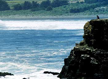
Punta de Lobos is simply a scenic place
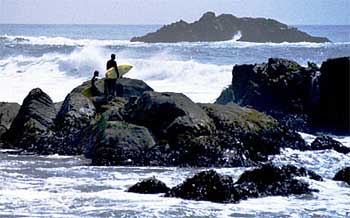
First we approached Pichilemu which is situated about 270 km (170 miles) from Santiago de Chile. The certainly most known place in matters of surfing also is a good base camp where you are put into the right mood when you see the guys dressed in wetsuits being busily carrying their surfboards. The small town mainly consists of 2 main "shopping streets" and you may like it or not. The left-handed, almost endless wave approaching Pichilemu's extended sandy beach cannot but be loved. Until dawn the guys keep paddling for one or another ride. As a windsurfer you actually have to be rather patient to be rewarded with adequate sailing conditions. The wind being too weak we decided to move South first and finally only had one opportunity to windsurf in Pichilemu.
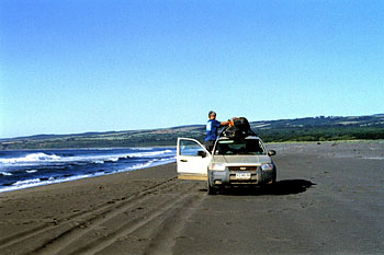
Pichilemu Beach
A completely different situation awaited us in Llico a small fishermens' place in the VII. Region ("Region Maule"). Here the wind really got going along with increasing sea-mainland thermal towards the afternoons. Already on the second day we went out with a 3.7 sqm sail and apocalyptic conditions. While the surf may not appear that high near the shoreline the betimes endless sequence of relatively quickly breaking lips gets you washed now and then. On that occasion you will be really glad to have brought a good wetsuit. The water is really damn cold! Seals enjoy swimming in that area. If you go out you'll face quiet a good series of ramps to jump. Even if jumping is not your objective you might be impressed by the outer sandbank's performance giving you plenty of time for enjoyable down the line wavesailing. According to our experiences the conditions also in Llico are not really consistent over periods of several days and although the overall weather situation may appear stable the thermal seems hardly predictable. On one day the sun shines and the icecold wind increases as you expected and on another apparently similar sunny midday you are befoged within only 10 minutes. In that case prefer riding just a few minutes upcountry with your car - as we did - and the sun is going to be on your side again!
It's up to you if you just go to Chile in order to hang around on the
beach. The country surprises the visitor on his trip with new facettes
of nature time and again. Though we only visited 2 regions of this 4,300
km (about 2,700 miles) long and only 140 km (90 miles) "narrow"
state we experienced an impressingly diversified landscape. Especially
during springtime Chile awaits you with a lush vegetation: Saturated green
of rolling hills contrasts shining yellow flowers covering ample meadows.
If you can perceive the peaks of the snow-covered Andes behind a lonely
lakeland area you are simply flabbergasted. O.k...., of course we came
to windsurf (as you "navigated" to this site for that reason)
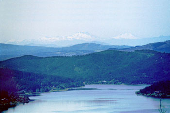
Lago Vichuquen in the North of the Region Maule
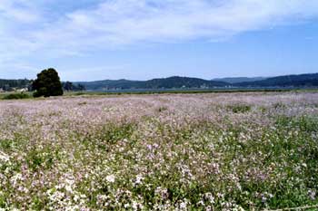
Landsape around Llico and Lago Vichuquen
Please contact me to receive the full article.
surfingdave
Sultanate Oman
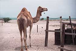
Camels are regarded to be obstinate from time to time and they seem to have a mind of their own. Some people think they are just ungainly others admire their elegance. Do you know why they do have such a superior, bored - not to say arrogant - look in their eyes? - No?
An ancient legend offers a reasonable explanation: "There are at least hundred names for Allah, but Muhammad let his followers only know 99 of them. Once he whispered the hundredst name into the ears of his favorite white camel to express his thanks for its support to escape in a dangerous situation. These news were circulated very soon among the other camels. That way all camels now do know the hundredst name of Allah, humans however don't. This is the real reason why all camels are that blasé, proud and arrogant..."
If you are on your way in Oman a camel might cross your path and force you to slam on the brakes to slow down your speed from some 100 km/h (60 mph) to walking speed and it will just spend a bored glance at you ('Stupid guy, why do you sound the horn in the desert...?) letting you past only leisurely. Then you might remember the legend. ;-)
The Sultanate of Oman is situated in the outermost south-east of the Arabian Peninsula. To the east it is limited by the Gulf of Oman and the Indian Ocean; the coast stretches over a length of about 1,700 km (1,060 miles) in total. While the Gulf of Oman offers luxurious hotels and more or less flat water conditions especially in the "Capital Area", the coast line along the rugged Indian Ocean promises lonesome beaches and thousand and one waves...
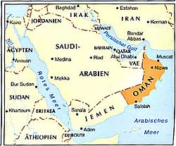
Keen on a little adventure? Not allergic to sand or temperatures between 35 and 40°C (95 - 104 °F)?
By the way, you can get there in a saloon car!
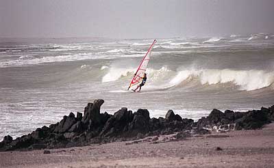
Our trip leads us from Muscat (sometimes also spelled 'Masqat'), the Sultanate's capital, over the range of the Hajar hills and further through an endless appearing desert to Shana'a, from where we take a ferry to reach the Island of Masirah, situated about 12 km (7.5 miles) from the mainland. Masirah Island - powerful place - is regularly striked by strong Monsun winds between June and August. The wind blows day and night from south-west (sideshore, righthand, wind speed between 16 and 20 knots in average, often freshing up to more than 30 knots). Just as the few inhabitants do you will call the wind 'Jarif' and you are going to hate it!
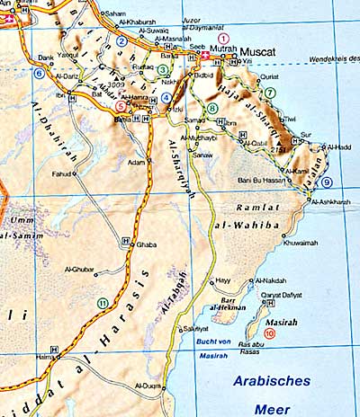
You'll need a visa to immigrate. Please contact your regional embassy for details. Book a flight to Muscat (e.g. via Dubai where lots of shopping tourists are going to get off the plane and will come back packed with plastic bags), rent a 4-wheel-driven car - the only thing besides the flight you might book well in advance of your trip - and start bright and early. The distance between Muscat and Masirah Island is about 400 km (250 miles). As the maps in trade more or less only contain a few sidled lines or are labeled incorrectly, a short route description is to follow. The problem you might face arizes from the various transcriptions of Arabic names into English. Thus e.g. for "Shana'a" one also reads "Sana", "Sanah" or "Shanna".
Starting right from the airport in Seeb follow the gorgeous motorway named according to Sultan Qaboos bin Said Al Said and head towards Bidbid - Nizwa at a roundabout. At Bidbid the route continues towards Al Mudhaybi (also spelled Al Mudaibi), highway No.23 moving into No.27. Stay on track. According to one of our maps the next junction is called Al Musalla, another indicates the name Sanaw. We think to have noticed the latter. If it becomes slightly confusing, just struggle through the place (however it should be named) and you will get to a splendidly constructed highway to the South (see yellow line on the roadmap on the left). Do not follow the signs towards Adam or towards Nizwa, otherwise you'll work up a sweat despite of any air condition. If the very last bushes ahead of the next following 200 km (125 miles) of pure emptiness throw their shadows to the east during the early afternoon hours you are right. Just get off your car once at a time. The coke might boil, hopefully the radiator will not ;-) Besides the road itself there are only very few signs of civilization, so you won't overlook the signpost to Masirah at a filling station. On the other hand you will be waiting for any signs during your drive along the glimmering highway. So, turn left and follow the well constructed road for the next 50 km (31 miles) to the ferry station. The road is going to curl over to the right after some time. Follow it, otherwise you will be landing somewhere in the desert, as we did. If you patiently stay on the tar road, it is a realy easy journey.
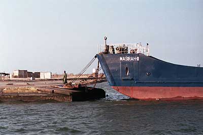
The ferry needs about an hour to Masirah Island - unless there should be a lot of goods to be loaded and vehicles to be taxied, as during our return. Then it might take already an hour to manoeuvre the trucks and cars. The crossing itself is relaxing just because of the seabreeze. If you are lucky you will be accompanied by dolphins during your journey.
Please contact me to receive the full article.
surfingdave
© 2024